
Something A Bit Different
Published 08:01 on 1 Nov 2014
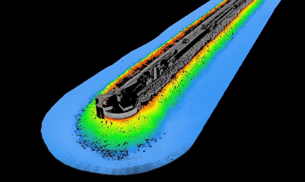
As some of you know, I have the joy of travelling Europe undertaking seabed Hydrographical and Geophysical surveys for a multitude of purposes. Luckily for me, this year I was involved in a Laser/Multibeam survey of the Portland Harbour walls. For those of you interested in the technical stuff. The Hydrographic survey was performed with dual system (0¬ and 45¬) multibeam echosounder, mounted 2.3m below the water line. Also an Intelligent Laser Range Imaging System was used to acquire point data of the exposed sections. This was mounted 2.4m above the water line on the cabin roof. The imagery was produced to a 0.2m resolution with GPS positioning processed to 0.1m accuracy. I hope some of you find these of interest. Gavin PoulloinLast updated 15:13 on 28 July 2025